
File:EU-Netherlands.svg

Size of this PNG preview of this SVG file: 713 × 600 pixels. Other resolutions: 285 × 240 pixels | 571 × 480 pixels | 913 × 768 pixels | 1,218 × 1,024 pixels | 2,435 × 2,048 pixels | 2,045 × 1,720 pixels.
Original file (SVG file, nominally 2,045 × 1,720 pixels, file size: 7.4 MB)
Summary
| Description |
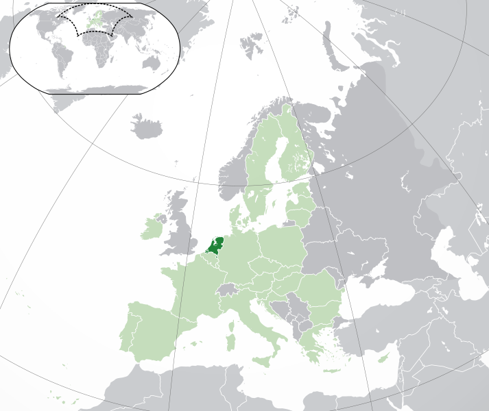
English: (Dark-Green) the Netherlands. (Light-Green) The rest of the European Union (EU). (Dark-gray) The rest of Europe. (Light-gray) The surrounding region.
See also: |
| SVG genesis | |
| Date | |
| Source | |
| Mwandiki | NuclearVacuum |
| Other versions |
.svg)
Licensing
I, the copyright holder of this work, hereby publish it under the following licenses:
This file is licensed under the Creative Commons Attribution-Share Alike 3.0 Unported license.
- You are free:
- to share – to copy, distribute and transmit the work
- to remix – to adapt the work
- Under the following conditions:
- attribution – You must give appropriate credit, provide a link to the license, and indicate if changes were made. You may do so in any reasonable manner, but not in any way that suggests the licensor endorses you or your use.
- share alike – If you remix, transform, or build upon the material, you must distribute your contributions under the same or compatible license as the original.

|
Permission is granted to copy, distribute and/or modify this document under the terms of the GNU Free Documentation License, Version 1.2 or any later version published by the Free Software Foundation; with no Invariant Sections, no Front-Cover Texts, and no Back-Cover Texts. A copy of the license is included in the section entitled GNU Free Documentation License. |
You may select the license of your choice.
File history
Click on a date/time to view the file as it appeared at that time.
| Date/Time | Thumbnail | Dimensions | User | Comment | |
|---|---|---|---|---|---|
| current | 07:59, 30 mweri wa itano 2020 | | 2,045 × 1,720 (7.4 MB) | Thayts | Fixed viewport outline on inserted map |
| 05:15, 1 mweri wa keri 2020 |  | 2,045 × 1,720 (7.33 MB) | Rob984 | UK and Gibraltar have left the EU. New base which includes all of Portugal's islands within frame, as well as Arctic Russian islands part of Europe. Also fixed Flevoland in the Netherlands. | |
| 20:33, 25 mweri wa ikumi 2016 |  | 2,045 × 1,720 (7.32 MB) | Giorgi Balakhadze | Rv of sockpuppet and per COM:OVERWRITE | |
| 16:26, 18 mweri wa gatato 2015 |  | 2,045 × 1,720 (7.38 MB) | Mapclean | Reverted to Leftcry's version, please go to your talk page | |
| 17:26, 9 mweri wa keri 2015 |  | 2,045 × 1,720 (2.61 MB) | VS6507 | Please don't change the consensus version | |
| 21:46, 2 mweri wa ikumi na igiri 2014 |  | 2,045 × 1,720 (7.38 MB) | Bobrayner | Back to the more accurate version | |
| 15:26, 17 mweri wa ikumi na imwe 2014 |  | 2,045 × 1,720 (2.61 MB) | VS6507 | Reverted to version as of 16:35, 16 November 2014 | |
| 19:35, 16 mweri wa ikumi na imwe 2014 |  | 2,045 × 1,720 (7.38 MB) | Leftcry | Reverted to version as of 22:27, 18 October 2014 Please go to your talk page | |
| 16:35, 16 mweri wa ikumi na imwe 2014 |  | 2,045 × 1,720 (2.61 MB) | A2D2 | The map must show the original de-jure status with no breakaway regions, as it was originally created. An alternative map showing the de-facto status with breakaway regions needs to be created instead. | |
| 15:46, 16 mweri wa ikumi na imwe 2014 |  | 2,045 × 1,720 (7.38 MB) | A2D2 | Reverted to version as of 21:30, 18 October 2014 |
File usage
The following page uses this file:
Global file usage
The following other wikis use this file:
- Usage on af.wikipedia.org
- Usage on als.wikipedia.org
- Usage on ami.wikipedia.org
- Usage on ang.wikipedia.org
- Usage on an.wikipedia.org
- Usage on arc.wikipedia.org
- Usage on ar.wikipedia.org
- Usage on arz.wikipedia.org
- Usage on avk.wikipedia.org
- Usage on av.wikipedia.org
- Usage on awa.wikipedia.org
- Usage on azb.wikipedia.org
- Usage on az.wikipedia.org
- Usage on az.wiktionary.org
- Usage on ban.wikipedia.org
- Usage on ba.wikipedia.org
- Usage on be.wikipedia.org
- Usage on bg.wikipedia.org
- Usage on bh.wikipedia.org
- Usage on bi.wikipedia.org
- Usage on blk.wikipedia.org
- Usage on bn.wikipedia.org
- Usage on bo.wikipedia.org
- Usage on bs.wikipedia.org
- Usage on bxr.wikipedia.org
- Usage on ca.wikipedia.org
- Usage on cdo.wikipedia.org
- Usage on chr.wikipedia.org
- Usage on chy.wikipedia.org
- Usage on ckb.wikipedia.org
- Usage on co.wikipedia.org
- Usage on cs.wikipedia.org
- Usage on cu.wikipedia.org
- Usage on da.wikipedia.org
- Usage on da.wiktionary.org
- Usage on de.wikipedia.org
- Usage on de.wiktionary.org
View more global usage of this file.