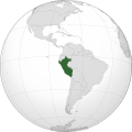
File:PER orthographic.svg

Size of this PNG preview of this SVG file: 551 × 551 pixels. Other resolutions: 240 × 240 pixels | 480 × 480 pixels | 768 × 768 pixels | 1,024 × 1,024 pixels | 2,048 × 2,048 pixels.
Original file (SVG file, nominally 551 × 551 pixels, file size: 1.23 MB)
File history
Click on a date/time to view the file as it appeared at that time.
| Date/Time | Thumbnail | Dimensions | User | Comment | |
|---|---|---|---|---|---|
| current | 03:09, 27 mweri wa muguaja 2018 |  | 551 × 551 (1.23 MB) | LeinadCQ | Oculto lagos. |
| 06:56, 6 mweri wa mbere 2015 |  | 551 × 551 (1.23 MB) | Denniss | Reverted to version as of 00:37, 20 January 2014 | |
| 03:37, 6 mweri wa mbere 2015 |  | 1,800 × 1,400 (534 KB) | Mondolkiri1 | Perú en UNASUR /Peru na UNASUL | |
| 00:37, 20 mweri wa mbere 2014 |  | 551 × 551 (1.23 MB) | Addicted04 | New map | |
| 22:26, 10 mweri wa ikumi na igiri 2011 |  | 550 × 550 (918 KB) | Addicted04 |
File usage
The following page uses this file:
Global file usage
The following other wikis use this file:
- Usage on ar.wikipedia.org
- مستخدم:جار الله/قائمة صور مقالات العلاقات الثنائية
- العلاقات الأمريكية البيروية
- العلاقات الأنغولية البيروية
- العلاقات البيروية الكورية الجنوبية
- العلاقات الإريترية البيروية
- العلاقات البيروية السويسرية
- العلاقات الألمانية البيروية
- العلاقات البيروية الليختنشتانية
- العلاقات البوليفية البيروية
- العلاقات البيروية الموزمبيقية
- العلاقات الألبانية البيروية
- العلاقات البلجيكية البيروية
- العلاقات الإثيوبية البيروية
- العلاقات البيروية البيلاروسية
- العلاقات البيروية الطاجيكستانية
- العلاقات البيروية الروسية
- العلاقات البيروية الرومانية
- العلاقات الأرجنتينية البيروية
- العلاقات البيروية الغامبية
- العلاقات البيروية القبرصية
- العلاقات البيروية السيراليونية
- العلاقات البيروية النيبالية
- العلاقات البيروية الليبيرية
- العلاقات التشيكية البيروية
- العلاقات البيروية الميانمارية
- العلاقات البيروية السعودية
- العلاقات البيروية الزيمبابوية
- العلاقات الإسرائيلية البيروية
- العلاقات البالاوية البيروية
- العلاقات البيروية المالية
- العلاقات البيروية النيجيرية
- العلاقات البيروية اليمنية
- العلاقات البيروية الفانواتية
- العلاقات البيروية الغابونية
- العلاقات البنمية البيروية
- العلاقات البيروية الكوبية
- العلاقات البيروية الجورجية
- العلاقات البيروية التونسية
- العلاقات البيروية الكورية الشمالية
- العلاقات البيروية الهندية
- العلاقات البيروية اليابانية
- العلاقات الإيطالية البيروية
- العلاقات البيروية الناوروية
- العلاقات الأسترالية البيروية
- العلاقات البيروية الزامبية
- العلاقات البيروية الفيجية
- العلاقات البيروية المارشالية
- العلاقات الأذربيجانية البيروية
- العلاقات البيروية السودانية
- العلاقات البيروية الكويتية
View more global usage of this file.
