
File:Xuancheng City Skyline.JPG

Size of this preview: 800 × 449 pixels. Other resolutions: 320 × 180 pixels | 640 × 360 pixels | 1,024 × 575 pixels | 1,280 × 719 pixels | 2,560 × 1,438 pixels | 3,927 × 2,206 pixels.
Original file (3,927 × 2,206 pixels, file size: 2.46 MB, MIME type: image/jpeg)
| Description |
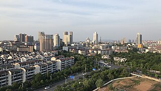
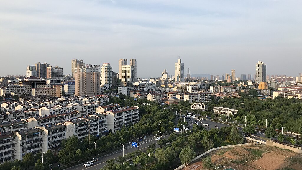
English: Skyline of Xuancheng City, Anhui Province, China
中文:宣城市(中华人民共和国安徽省)天际线 |
| Date | |
| Source | Own work |
| Mwandiki | Zhousiyuan |
| Permission (Reusing this file) |
This file is licensed under the Creative Commons Attribution 2.0 Generic license.
|
| Other versions | File:Xuancheng City Skyline (2).JPG |
.JPG)
| Camera location | | View this and other nearby images on: OpenStreetMap |
|---|
File history
Click on a date/time to view the file as it appeared at that time.
| Date/Time | Thumbnail | Dimensions | User | Comment | |
|---|---|---|---|---|---|
| current | 11:04, 26 mweri wa gatadato 2019 | | 3,927 × 2,206 (2.46 MB) | Zhousiyuan | New shot in June, 2019 |
| 09:12, 15 mweri wa muguaja 2016 |  | 4,160 × 3,120 (3.66 MB) | Zhousiyuan | updated 2016-7-15 | |
| 03:37, 25 mweri wa gatadato 2014 |  | 4,608 × 3,125 (7.58 MB) | Zhousiyuan | ||
| 06:04, 18 mweri wa kanana 2011 |  | 2,816 × 1,944 (689 KB) | Zhousiyuan | {{Information |Description ={{en|1=Skyline of Xuancheng City,Anhui province,China}} {{zh|1=宣城市(中华人民共和国安徽省)天际线}} |Source ={{own}} |Author =Zhousiyuan |Date =2011-08-12 |Pe |
File usage
The following page uses this file:
Global file usage
The following other wikis use this file:
- Usage on ar.wikipedia.org
- Usage on cs.wikipedia.org
- Usage on cy.wikipedia.org
- Usage on de.wikipedia.org
- Usage on en.wikipedia.org
- Usage on es.wikipedia.org
- Usage on eu.wikipedia.org
- Usage on fa.wikipedia.org
- Usage on fi.wikipedia.org
- Usage on fr.wikipedia.org
- Usage on hy.wikipedia.org
- Usage on id.wikipedia.org
- Usage on it.wikipedia.org
- Usage on ku.wikipedia.org
- Usage on pam.wikipedia.org
- Usage on pl.wikipedia.org
- Usage on ru.wikipedia.org
- Usage on sv.wikipedia.org
- Usage on tr.wikipedia.org
- Usage on uk.wikipedia.org
- Usage on ur.wikipedia.org
- Usage on uz.wikipedia.org
- Usage on vi.wikipedia.org
- Usage on www.wikidata.org
- Usage on wuu.wikipedia.org
- Usage on zh.wikipedia.org